US National Forest shields #246
Comments
Could some mappers be using these two values to distinguish between forest primary and secondary routes? Or is this just a slow-motion transition from one tag to the other? Puerto Rico (#240) also has Bosque Nacional shields that would look identical to the National Forest shields after simplification. |
|
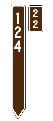
Oop. Clearly I needed to do a little more investigation. There are National Forest primary and secondary routes, though current The guidelines say to include the name of the National Forest in the National Forest secondary route shields can be horizontal or vertical, depending on the level of maintenance of the roadway. The horizontal shields represent well-maintained roads that average vehicles can drive, while vertical shields represent less-maintained roads more suitable for hikers or 4-wheel drive vehicles. FSTopo maps distinguish all three shield designs, but there is currently no tagging scheme to distinguish horizontal from vertical shields. |

|
While the shields are standardized across all Forests, the route numbers are only unique within a single Forest. |
|
It's okay to reuse |
|
Just checked US Forest Service Route tagging in Washington and it is definitely rough. I counted 118 roads that I believe would be deserving of |
|
Separated BIA routes into a new ticket: #351 |
|
Once #355 is merged, the shield artwork will be available for these routes. The only thing left to do is reach consensus on tagging 😬 |
|
NF shields would be a nice addition to coincide with rendering tracks (#717). 😀 Example at |

|
If anything else, I wonder if we should chunk this into two different issues.
I'd advocate for doing Forest Highways first, as they're more important and the problem is vastly easier than for Forest Roads. Forest Highways have only one shape and color across the country, and are predictably maintained. Forest Roads have what appears to be three different shapes, and two different orientations (horizontal and vertical, whereas sometimes the vertical signs have a down arrow in the shape, and other times not). Forest Highways should also always be signed, whereas Forest Roads are more likely to be all over the place. My hope is that by starting small (actually big, the Forest Highways), maybe it could encourage more tagging in OSM and thus, more interest in tackling the bigger challenge of Forest Roads. Tagging Thoughts? My two takeaways were:
|
|
This subject has come up periodically in the OSM-US Slack, but nothing conclusive has come out of the discussion yet. The tagging scheme you're describing is pretty close to what I came up with, except my values were prefixed |
|
Taking the less formal route for a tagging proposal: https://community.openstreetmap.org/t/network-tagging-proposal-for-usfs-roads/97057 |
|
Are there any updates on this? Just mentioning because I found https://www.openstreetmap.org/relation/9443117 while adding Albany County WY route relations and it brought the topic to my mind. |
|
I'm not clear on whether we have agreement on the tagging for these roads -- if that's settled out, then PR is certainly welcome. |
While we have a convenient map to indicate progress on state-level shields, we can't forget about the remaining federal shields. The United States Forest Service signposts its own numbered routes in and around the federal lands it manages.
Relation coverage is currently incomplete.
networkvalues for Forest Routes includeUS:FSandUS:NF. This would need to be standardized before moving forward with implementing shields. Both networks typically have up to 3 digits in theirrefvalues, though I wouldn't be surprised if there were ones out there with 4 digits.Forest Route shield:
The text was updated successfully, but these errors were encountered: